Welcome to Techmapperz GIS Projects
Explore our comprehensive GIS-based Mapping and Spatial Data Visualisation projects. From Urban Planning to Agricultural Mapping, discover how we transform Spatial Data into actionable insights.
Contact UsExplore our comprehensive GIS-based Mapping and Spatial Data Visualisation projects. From Urban Planning to Agricultural Mapping, discover how we transform Spatial Data into actionable insights.
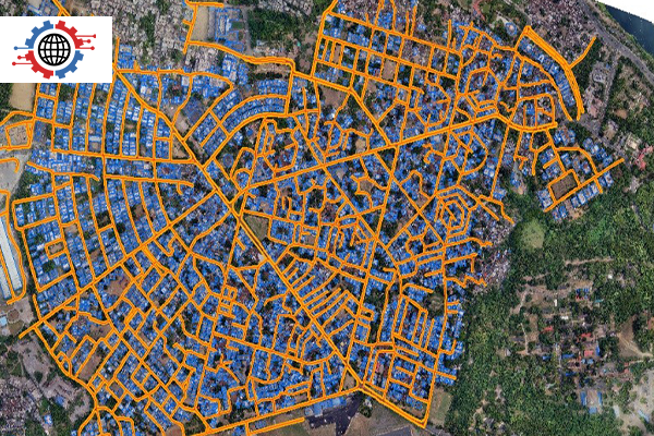
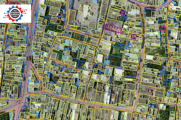
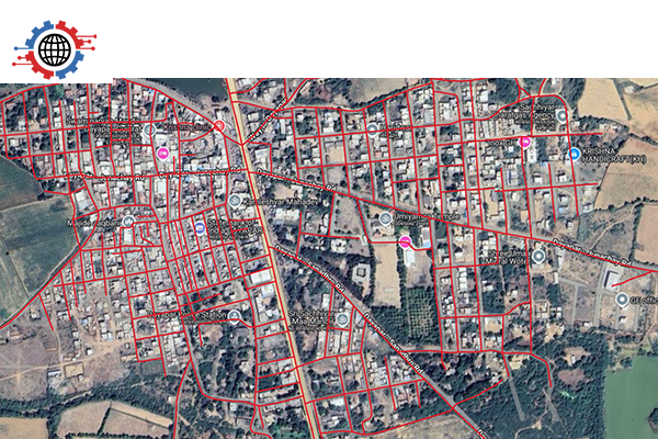
Contact UsCity Mapping
The project focused on creating a detailed digital representation of Land use, Infrastructure, and demographics to support informed Urban Planning.
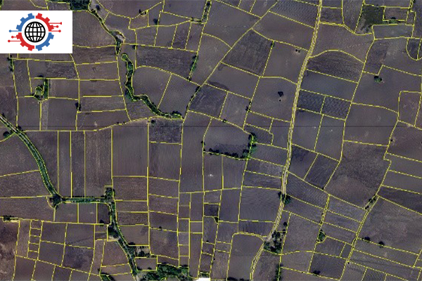
Agricultural Mapping
This project applied Spatial Data and GIS techniques to enhance Agricultural Productivity, Sustainability, and Environmental Monitoring.
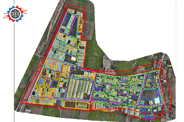
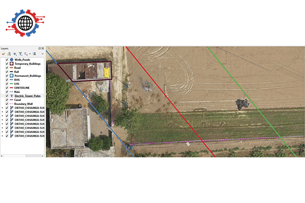
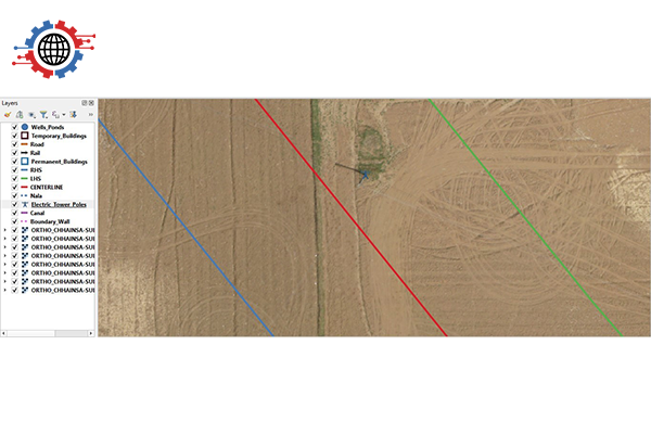
Industrial Planning & Mapping
The project focused on Spatial Data-based Industrial Planning and Landbank Identification to support the development of industrial corridors and clusters in Rajasthan.
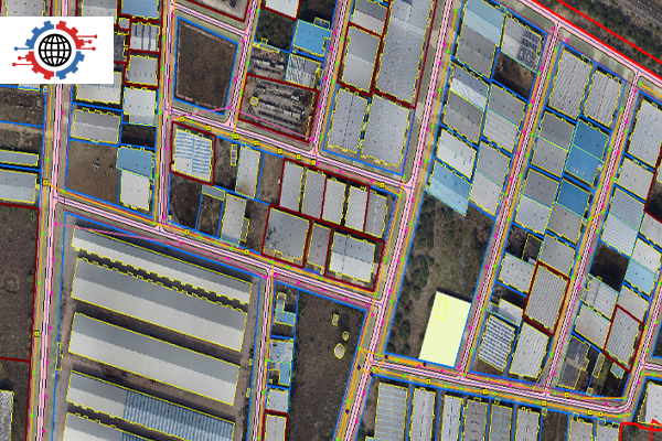
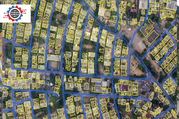
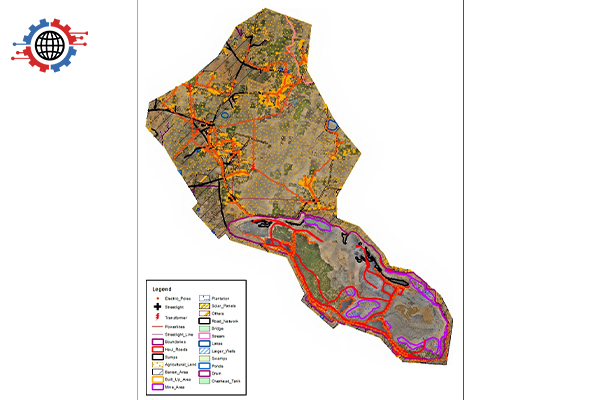
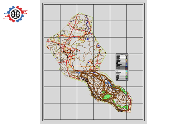
Landuse-Landcover Mapping
This project involved GIS-based mapping of habitation areas to support Land use planning, Sustainable Development, and environmentally responsible Infrastructure.
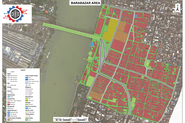
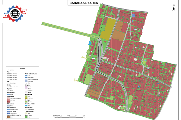
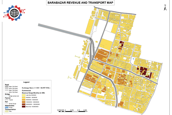
Hooghly Riverfront
This project involved GIS-based Spatial Mapping of the Hooghly Riverfront in the KMDA region and Land Use Assessment of key jetties and commercial zones.
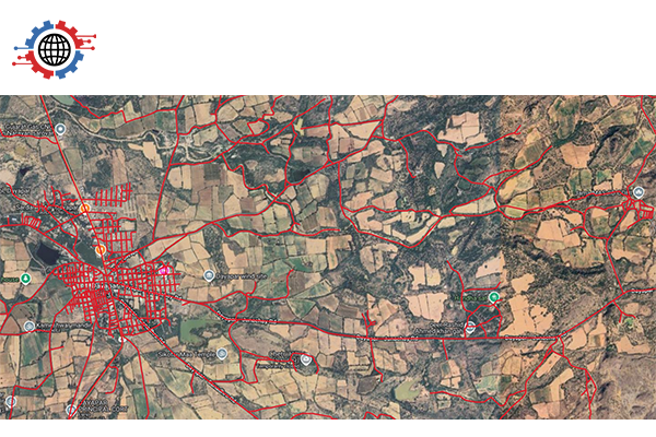
Navigation Mapping
Navigation mapping provides accurate Geospatial Data to support smarter transportation planning and mobility. It enhances infrastructure efficiency, public engagement, and decision-making.
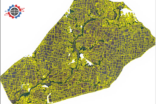
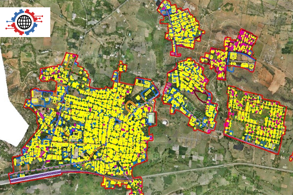
LULC (Cadastral)- Meghalaya
This project is focused on generating high-resolution Land-use Land-cover (LULC) data for Cadastral-Level Mapping in Meghalaya using drone imagery. The aim was to support land management, planning, and record digitization through accurate Spatial Data.
- Meghalaya_1.png)
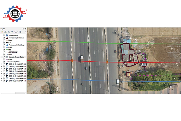
Mining
This project involved the extraction of 2D features from High-Resolution Drone Imagery of a mining area to generate a detailed CAD-compatible map. The mapping provided critical Infrastructure, Utility, and Land Classification data for better planning and monitoring.
GAIL – Pipeline Corridor Mapping
The project involved High-Resolution Drone-Based Mapping to extract and document features along the GAIL pipeline corridor. The goal was to monitor ground realities and support asset management and planning.
We appreciate your interest in Techmapperz GIS Projects.
Our team will get in touch with you shortly.